The Quest for Takakkaw Falls (aka The Falls That Got Away)
Wednesday, April 11th,
2001 - Evening: The long weekend was just around the bend and after spending
a few too many weekends playing video games and watching movies I figured
it is about time that I actually got out and enjoyed some of my surroundings.
I had been told that there was beautiful scenery if I set off north of
Whistler. Sounded like a pretty good plan. I could hop in my car and simply
drive. But what's a journey without a destination? Of course some of the
best journeys never involve a specific destination but I figured I should
have one anyway. So I ended up doing a search on waterfalls in BC to see
if there was anything interesting in that general vicinity. Up came Takakkaw
Falls, located in the Yoho National Park. Sounded good to me. It is supposed
to be one of the highest falls in Canada. (Accounts vary from it being
the highest waterfall in all North America to the 3rd highest in Canada.
And in the world, it is ranked #8, #11, #13, or not even in the top 20.
I think people need a better standard for measuring waterfalls!)
Anyway, regardless of where
the falls stood up in the scope of things, I wanted to get away and that
sounded like a good direction. So I tossed a foam mattress in the back
of my car along with pillows, a sleeping bag, and prepared to set off the
next day after work.
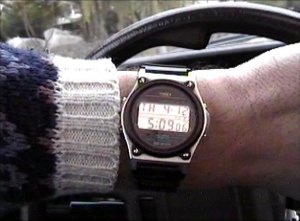 |
Thursday, April
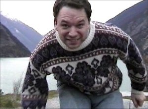
11th, 2001 - 5:09pm: With my trusty camcorder at my side I set off from
Whistler Village in a slight rain and began my journey north. I figured
it would be a little over 1600 km round trip. I said a few kind words to
my car before taking off, saying that if it managed to make the trip okay,
I would pay for that tune-up it keeps asking for. I checked out the map
and planned on hitting Lillooet before dark, pulling off somewhere for
the night, and then journeying on to Field (next door to the Takakkaw Falls)
by the next evening. Saturday could then be spent exploring the area with
Sunday reserved for the long drive back to Whistler. |
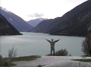  |
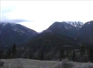
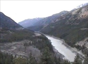
Just before
reaching Lillooet, I pulled over to enjoy the view of Seton Lake. Now if
only the colors were right, then you could see just how green that lake
actually is. A beautiful spot, but a little too cold for a swim today. |
| It started to
get dark a little after 8pm so I began looking for a place to pull over
for the night. Some place not too far off the main road but far enough
to be out of sight. Didn't want any strange intruders tapping on my window
in the middle of the night. And I ended up finding a perfect little spot
about halfway between Lillooet and Lytton. The hardest part was trying
to convince my body that it was time to go to bed at nine in the evening.
In the end, I didn't get to sleep until after one anyway. (The back of
my car is not quite long enough to fully stretch out in so it was a little
hard to get used to.) |
 |
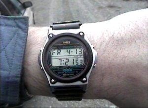  |
Friday, April
13th, 2001 - Hard to sleep in when you have the sun streaming in through
all the windows. So I was up bright and early the next morning. Didn't
get a great sleep, but it was a little cheaper than the Holiday Inn. After
a lovely breakfast consisting of a banana and some Froot Loops, I was on
my way once again. |
| After I hit
Lytton, I turned north once again to visit Spences Bridge. The movie "The
Sweet Hereafter" was mostly filmed in Spences Bridge and Merritt so I decided
to make a detour and check out the two places in case I could see anything
familiar. However, I came away empty-handed. I suppose I should have asked
one of the locals if they could point me in the right direction. Still,
I did manage to catch some more nice scenery along the way and then grabbed
a real breakfast at an A&W in Merritt. |
  |
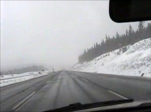  |
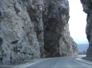
From Merritt,
I headed north once again, towards Kamloops. Ran into a fair bit of snow.
Turned to rain once I hit Kamloops and then the sun came out again as I
set off east towards Chase, Salmon Arm, and Revelstoke. |
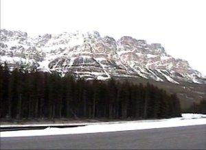
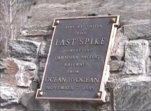
| Stopped off
in Craigellachie for a moment to see the spot where the last spike of Canada's
first cross country railway was driven in. I was disappointed that they
didn't seem to actually have THE spike on display. I suppose someone would
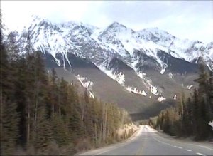
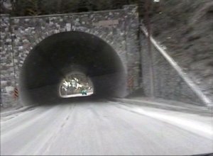
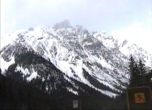
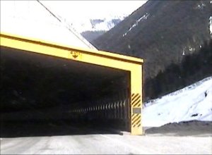
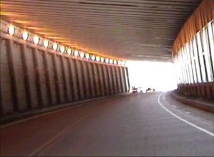
try and steal it if they did. Then it was on to some more mountains and
an interesting series of little tunnels. |
  |
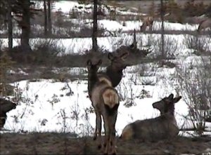
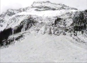
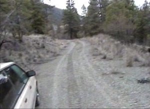
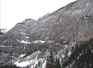
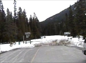
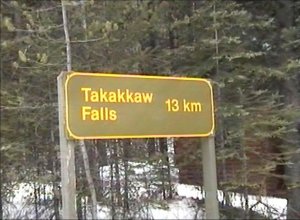
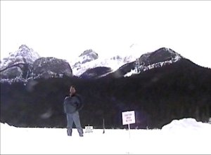
| Up early again
on Saturday morning. Breakfast at Humpty's and then back to Field for my
quest to find Takakkaw Falls. In the summer time, you can drive your car
close to the falls and you only need to hike if you want to get right to
the base. Unfortunately, the road was buried under snow this time of year
and as you can see from the sign, it is a wee bit of a trek to get to the
falls on foot. However, after driving 800 km, I didn't want 13 km to stop
me. Besides, I figured that I would probably be able to see the falls long
before the end. |
  |
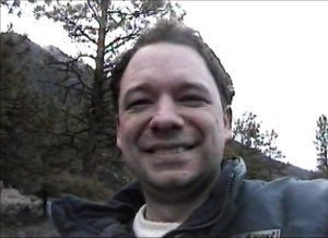
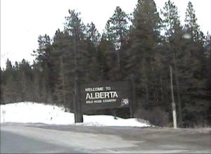
| After my unsuccessful
quest to find the waterfalls, part of me was tempted to simply head back
to Whistler. Eight hours of driving would have me back in my bed before
midnight. However, that would have been cheating and it would have also
wasted the extra day of the long weekend. So, instead of turning right
from the parking lot and heading west, I turned left and set off towards
Alberta. Five minutes later I crossed into Alberta and stopped off in Lake
Louise. The lake was a wee bit too frozen over to be tempting for a swim. |
  |
| Without any
way of recharging my camcorder, the batteries had gone dead at this point
so I couldn't get any more pictures. I was up the next morning before 7
and set off on the 8 hour drive back to Whstler. It was mostly backtracking
but I did end up taking a different route after Kamloops and encountered
some beautiful areas around Cache Creek.
I was back in
Whistler by 4pm and ready to take a nice long shower and a good night's
sleep in a real bed. Ahhhhhhhhhhh! |
 |